Feeds:
Posts
Comments

Lost America

The Lewis & Clark Herbarium at the Academy of Natural Sciences of Drexel University houses almost all the plant specimens collected by Meriwether Lewis and William Clark on their journey, including many newly discovered species. The federal program Save America’s Treasures paid to rehouse the collection to modern standards.

We don’t usually editorialize or advocate here, but today I’m going to make an exception. As some of our fans may have noticed, blogging hasn’t been as regular around here as our usual standard. The reason has been a time-consuming job search for one-half of the writing team of “Frances Hunter.” Fortunately that’s now resolved. Hopefully that will free up time and emotional energy for fun things like this blog.

Anyone who has taken a peek at the bio section may have noticed that one of us has been fortunate enough to work in a history-related field. As of December 1, that will no longer be the case, for that job fell victim to the budget ax along with so many others in public history.

Consider the current state of this nation’s commitment to our own heritage (thanks to American Heritage magazine for their great editorial roundup of this information):

– Completely eliminated: Save America’s Treasures, the program that saved countless American courthouses, document collections, battleships, historic homes, Native American sites like the Acoma Pueblo, and artifacts like the Gettysburg Cyclorama, the Rosa Parks bus, and the Star-Spangled Banner itself.

– Completely eliminated: Preserve America, which helped small towns and ethnic neighborhoods plan how to preserve entire areas of historic character, developing programs like walking tours, markers, and historic drives.

– Completely eliminated: Teaching American History, which provides grants for public school teachers to undertake intensive study to better teach the American story to kids.

– Completely eliminated: We the People, which funded teacher training, purchased classic books and art for public schools, and sponsored the National Digital Newspaper Project, a program to digitize and put online historic American newspapers from the 1880s to the 1920s.

– Completely eliminated: The National Heritage and Scenic Byways program. Among many others, this ends support for the Heritage Area around the Knife River Village in North Dakota, where Lewis and Clark met Sacagawea, eliminated the chance for a National Heritage Area to preserve Lewis and Clark’s legacy on the West Coast, and ends support for scenic byways along the Lewis & Clark Trail including the Native American Scenic Byway in the Dakotas and the Northwest Passage Scenic Byway in Idaho — not to mention the Natchez Trace.

The Native American Scenic Byway guides visitors through four of the reservations of the Lakota Sioux. It encompasses many of the historic sites of the Lewis & Clark Expedition. The program has been eliminated after a 20-year run.

I recently found a reprint of a great book called Lost America, by Constance M. Greiff. Originally published in 1971, Lost America is a pictorial tour of landmark buildings that had been destroyed by neglect and the wrecking ball. In her introduction, Greiff has an excellent analysis of what caused the wholesale destruction of thousands of architectural treasures in our country, particularly from the 1940s to the 1970s. Much of the demolition was the result of a promise made to the nation’s veterans. The GI Bill granted low-cost mortgages to the men who had fought so gallantly in World War II. To make way for the new homes, America’s small towns and villages were converted to suburbs. Urban renewal took much of the rest. After all, what were some crummy old buildings when people needed highways to drive in from their new homes and places to park once they got there?

Greiff identifies a particularly dangerous period for historical sites, writing, “We tend to denigrate the tastes of the generation or two immediately preceding our own at the same time we are attracted to the lifestyle of their predecessors, first, perhaps, as merely amusingly quaint, and then as the object of serious study and admiration … The buildings of [the] past were viewed with contempt as examples of crudity and bad taste. … They were objects to be discarded…” In another book from my library, The Gingerbread Age by John Maass (1957), the author writes of his efforts to photograph America’s Victorian heritage. There was a period of several years where Maass simply could not drive fast enough. He would get wind of a site to photograph and get there only to find out it has been torn down just days before.

The Genie Car Wash sign (1968), Austin, Texas.

My own city is a growing one in which the past is obliterated on an almost daily basis. Recently, citizens did battle to save a vintage neon car wash sign. The passion invoked by such an unremarkable object spoke volumes to the sense of loss experienced by ordinary citizens — again and again supporters  used the sad, desperate words: It’s all that’s left. (The sign was saved.)

The wanton destruction of the post-war era was symbolized most dramatically by the mindless demolition of the fabulous Penn Station in New York, which eventually led to the modern preservation movement. A lot of time has passed since then. The elimination of federal funding for historic preservation says it all about the nation’s current level of commitment to its heritage — it’s not worth a dime. Similarly, states are starving their historic parks and monuments with reduced hours and maintenance, and cutting back on access and preservation of historic archives. Though the battle is ongoing, budget cuts in Georgia aim to eliminate their state archives altogether, ending public access to hundreds of years’ worth of historical documents and artifacts.

A number of Lewis & Clark sites are seriously endangered. Just to cite the most recent example, a high-ranking official of the National Park Service warned that Lewis & Clark National Park in Astoria (site of Fort Clatsop) will be forever changed if a proposed terminal for liquified natural gas is built just three miles away. Visitors will no longer be able to experience the Lower Columbia River with a sense of the beauty that Lewis and Clark experienced.

Paddlers experience the Lower Columbia River Water Trail. Courtesy Lower Columbia Estuary Partnership.

What do you think? It’s all up to us, and we can’t count on any help from Uncle Sam this time around. If I ever saw a time when “think global, act local” applied, it is in the siege now underway on America’s historical treasures. What books will go unresearched and unwritten when archives are shuttered? What architectural treasures will be neglected, burned, or razed for short-term economic gain? Which of the post-war buildings, now aging themselves, will be labeled monstrosities and meet the fate of their Victorian predecessors? What sites of the Lewis & Clark Trail will be despoiled? What photographs will represent our era in a future Lost America? What will our children and grandchildren say about us?

Once it’s gone, it’s gone forever: Penn Station, 1910-1963. The New York Times wrote, “Until the first blow fell, no one was convinced that Penn Station really would be demolished, or that New York would permit this monumental act of vandalism against one of the largest and finest landmarks of its age of Roman elegance.”

Imagine being lost in an unfamiliar wilderness for sixteen days, without food, shelter, ammunition, or any way to let your companions know where you were. Such was the fate of Private George Shannon, the youngest member of the Lewis & Clark Expedition. Only 18 years old when he joined Lewis & Clark’s party in October 1803, Shannon literally grew up along the trail. In the course of the 2 ½ year journey, he suffered one of the most harrowing ordeals of all the men of the Corps of Discovery– facing the wilderness totally alone.

George Shannon

Artist’s rendering of George Shannon

George Shannon was born in 1785 in Washington County, Pennsylvania, an intelligent young man from a good family. He met Meriwether Lewis in Pittsburgh in 1803, while Lewis was awaiting the completion of the expedition’s keelboat.  Shannon was one of three men Lewis took along from Pittsburgh on a trial basis. He officially signed on at Maysville, Kentucky on October 19, 1803, and is usually considered one of the “nine young men from Kentucky,” although his ties to Kentucky were forged later. Shannon was hired onto the expedition as a hunter, at the rank of private. His salary was $25 per month.

Shannon wintered over at Camp Dubois with the rest of the Corps, and was placed in the first squad under Sergeant Nathaniel Pryor. He seems to have been considered a capable and reliable young man, who rarely caused the captains any trouble.The captains thought enough of Shannon’s abilities that they tapped him to discharge Pryor’s duties should Pryor need to be absent from the squad.

Shannon’s ordeal began on August 26, 1804, when he was detailed to search for two missing pack horses near Spirit Mound in present-day South Dakota. Shannon found the horses quickly and proceeded upriver, believing the rest of the Corps to be ahead of him. In fact, the Corps was actually trailing him. With only a rifle and a handful of ammunition, Shannon wandered alone in the wilderness for the next sixteen days, desperately trying to catch up to his companions.

A skilled hunter, Shannon was able to kill his own food until his ammunition ran out, several days after he went missing. He was forced to abandon one of the pack horses which gave out in the wilderness. Loading his rifle with a hard stick, he managed to bring down one rabbit. Otherwise, he survived by eating grapes, keeping the second pack horse in reserve as a last resort.

Finally, on September 11, 1804, Shannon spied the Corps of Discovery coming up the river. One can only imagine his emotions upon finally being reunited with his fellows. A relieved Captain Clark wrote in his journal:

here the man who left us with the horses 16 days ago and has been a head ever Since joined, us nearly Starved to Death, he had been 12 days without any thing to eate but Grapes & one Rabit, which he Killed by shooting a piece of hard Stick in place of a ball—. This man Supposeing the boat to be a head pushed on as long as he Could, when he became weak and feeble deturmined to lay by and waite for a tradeing boat, which is expected  Keeping one horse for the last resorse,—    thus a man had like to have Starved to death in a land of Plenty for the want of Bulletes or Something to kill his meat.

Private Shannon Lost Map

Children’s map – “Where in the World is Private George Shannon?”

Unfortunately for Shannon, it wasn’t the last time he got lost. On August 6, 1805, he was sent out to hunt near the Three Forks, a dangerous and confusing area inhabited by unfamiliar Indians. It was a stressful day for the Corps, with Clark ailing from a hurt ankle and Private Whitehouse seriously injured from almost being crushed by a canoe. A harried Captain Lewis wrote in his journal that night:

Shannon had been dispatched up the rapid fork this morning to hunt, by Capt Clark before he met with Drewyer or learnt his mistake in the rivers. When he returned he sent Drewyer in surch of him, but he rejoined us this evening and reported that he had been several miles up the river and could find nothing of him.    we had the trumpet sounded and fired several guns but he did not join us this evening. I am fearful he is lost again. this is the same man who was seperated from us 15 days as we came up the Missouri and subsisted 9 days of that time on grapes only.

Lewis sent Reubin Fields in search of Shannon, but Fields returned on August 8 and “reported that he had been up Wisdom river some miles above where it entered the mountain and could find nothing of Shannon.”  But the next day, Lewis happily reported that Shannon had finally rejoined the group.

while we halted here Shannon arrived, and informed us that having missed the party the day on which he set out he had returned the next morning to the place from whence he had set out or furst left them and not finding that he had supposed that they wer above him; that he then set out and marched one day up wisdom river, by which time he was convinced that they were not above him as the river could not be navigated; he then returned to the forks and had pursued us up this river.    he brought the skins of three deer which he had killed which he said were in good order. he had lived very plentifully this trip but looked a good deel worried with his march.

Shannon suffered some minor mishaps during the remainder of the expedition, but was careful not to get lost on the return trip. He returned up the Missouri River in 1807, on an ill-fated fur-trading expedition that had the added goal of returning Mandan chief Sheheke to his village. The party was attacked by the Arikara Indians, and Shannon suffered a bullet wound that broke his leg. By the time the party straggled back down the river, gangrene had set in and Shannon was not expected to live. Shannon’s amputated leg was buried at Fort Bellefontaine on the bank of the Missouri River. The young man survived, but his exploring days were over. He was still only 22.

George Shannon memorial in Lexington, Kentucky

George Shannon memorial in Lexington, Kentucky

Shannon went on to study law in Lexington, Kentucky. In the spring of 1810, William Clark recruited him to travel to Philadelphia to assist Nicholas Biddle with editing the Lewis and Clark journals. Clark’s letter of introduction stated that Shannon “possesses a sincere and undisguised heart, he is highly spoken of by all his acquaintances and much respected at the Lexington University where he has been for the last two years.”

After his involvement with the Lewis and Clark journals, Shannon returned to Kentucky, married into a prominent Lexington family, fathered seven children, and embarked on a turbulent legal and political career in Kentucky and Missouri that spanned almost three decades. George Shannon died suddenly August 30, 1836 at the age of 51. A St. Louis newspaper reported that his masonic funeral was attended by “a large assemblage of the ladies and gentlemen of the town … to offer their last testimony of respect to the remains of a good man.” He is buried in an unmarked grave in the Massie Mill Cemetery near Palmyra, Missouri.

The compelling story of Shannon’s ordeal in the wilderness continues to resonate with students of the Lewis and Clark expedition, especially young people. Shannon is the subject of several children’s books, second only to the expedition’s dog, Seaman.

Location: Natchez,  Mississippi

View from Emerald Mound near Natchez, Mississippi

Our recent blog on Cahokia Mounds described the culture of the mound builders, whose handiwork all over the American landscape would have been part of everyday life for Meriwether Lewis and William Clark. Cahokia Mounds is a great stop for those in the St. Louis area. Today I want to talk about a couple of sites that are equally fascinating and easily accessible to those retracing the last journey of Meriwether Lewis along the Natchez Trace.

Emerald Mound was constructed about 1400. Second only to Monk’s Mound at Cahokia in size, it would have been the site of an enormous temple that served the ancestors of the Natchez Indians. It is believed to have continued to be used for about three centuries. Studying the residents and how they lived is frustrating because much of the site, including a number of additional mounds, was destroyed by farming before the National Park Service stepped into  preserve it  starting in the 1950s. Today, you can easily walk to the top of Emerald Mound.

These ancestors would have been among the Native Americans who violently repulsed the first Europeans to visit the area back in1542, when Hernando de Soto and the Spanish came calling. Unfortunately, the Spanish probably had the last laugh, as foreign diseases swept through the people of the area in the next decades. By the time the French ventured up the river 140 years later, the earlier civilization had been replaced by the Natchez, who lived not far from Emerald Mound in a city known as the “Grand Village.” Other smaller villages of Natchez Indians were scattered in the surrounding area.

The Grand Village was impressive to the French, though its ceremonial plaza and temple mound were much smaller than those found at Emerald Mound and Cahokia (it is believed to have been constructed back around 1200 and then resettled.) At first it seemed that the French and the Natchez might have a lot in common. The Natchez were ruled by a man known as the “Great Sun” (not unlike the French Sun King) and his brother, the Tattooed Serpent. A highly complex and stratified society still held proudly to its traditions on a spot with some of the richest farmland in America and a well-tended forest loaded with deer, walnuts, and peaches, plums, and figs.The French established reasonably decent relations with the Natchez and documented many of their beliefs, ceremonies, and customs, which included human sacrifice, ritual suicide, and infanticide.

In 1716, after four French traders were murdered by Natchez, the French set up a garrison known as Fort Rosalie. A handful of soldiers maintained the fort to protect French traders, those tobacco farmers crazy or desperate enough to seek their fortune in one of the most remote areas on the planet, their families, and their African slaves.

Mary with one of the reconstructed dwellings at the Grand Village of the Natchez

The Great Sun died in 1728, and his successor, the Young Sun, lost any control over his people, who were fed up with the French demanding more land for tobacco farming. In an incident reminiscent of today’s headlines, Natchez warriors strolled into Fort Rosalie and asked to borrow the garrison’s guns. To the surprise of the French, they proceeded to slaughter some 200 men and take hundreds of women, children, and slaves back to their village, where they were held hostage. (The slaves were given the option of becoming Natchez and many did.)

The incident proved to the last stand for the Natchez. In the war that followed, the French, along with Choctaw allies, hunted down the Natchez and took a terrible revenge. The Natchez were driven from the Grand Village and other towns. Those not killed were sold into slavery in the West Indies. A handful escaped to join the Cherokee and Creek, but their civilization disappeared forever. The region was completely destabilized, and war continued among area Indians for years, with lasting consequences. The French chose to arm their slaves, leading to a path to freedom and a free black society that had a huge impact on the history of Louisiana.

Archeological work began at the site of the Grand Village in the 1930s. Today you can visit the site, explore the mounds, and take in a small but very informative museum.

I know there are many other surviving Indian mound sites in the United States, including other smaller mounds along the Natchez Trace. I’d love to visit many more sites. If you have a site you recommend, please leave a comment.

For more reading:

Ancient Architects of the Mississippi

Indian Mounds of Mississippi

On a cold, rainy Sunday in December 1805, William Clark was dealing with sick men, hard-bargaining Indians, and spoiled elk.  However, he was quick to note in his journal that a welcome bit of novelty had crept into the dreary routine at Fort Clatsop. “We were informed day before yesterday that a whale had foundered on the coast to the S. W. near the Kil a mox [Tillamook] N. and that the greater part of the Clat Sops were gorn for the oile & blubber,” Clark wrote. “The wind proves too high for us to proceed by water to See this monster, Capt Lewis has been in readiness Since we first heard of the whale to go and see it and collect Some of its Oil, the wind has proved too high as yet for him to proceed.”

Beached blue whale carcass

Beached blue whale carcass

The sight of a whale would indeed have been a novelty. In 1805, the ascent of the New England whaling industry was still 15 years away, and Lewis and Clark would have known whales mostly as a source for lamp oil and candle wax.

One week after first hearing about the whale, Lewis and Clark got their first taste of the big fish from a couple of their own men who were employed at the Salt Camp. On January 5, 1806, Clark noted, “At 5 p. m. Willard and Wiser returned, they had not been lost as we expected.    they informd us that it was not untill the 5th day after leaveing the fort, that they Could find a Convenient place for makeing Salt; that they had at length established themselves on the Sea Coast about 15 miles S. W. from this, near the houses of Some Clat Sop & Kil a mox families; that the Indians were very friendly and had given them a considerable quantity of the blubber of the whale which perished on the Coast Some distance S. E. of them.”

Willard and Wiser had brought some of the whale blubber to Fort Clatsop. Ever the epicurean, Lewis was anxious to sample the whale meat. “It was white & not unlike the fat of Poark, tho’ the texture was more spongey and somewhat coarser,” he wrote. “I had a part of it cooked and found it very pallitable and tender, it resembled the beaver or the dog in flavor.”

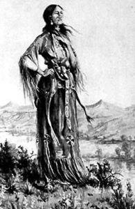
Sacagawea

“the Indian woman was very impotunate to be permited to go”

His curiosity piqued, Clark determined “to Set out early tomorrow with two canoes & 12 men in quest of the whale or at all events to purchase from the indians a parcel of the blubber.” The next day, he picked up one additional passenger. Sacagawea had heard about the whale and was not about to be left behind. Lewis recorded, “Capt Clark set out after an early breakfast with the party in two canoes as had been concerted the last evening; Charbono and his Indian woman were also of the party; the Indian woman was very impotunate to be permited to go, and was therefore indulged; she observed that she had traveled a long way with us to see the great waters, and that now that monstrous fish was also to be seen, she thought it very hard she could not be permitted to see either (she had never yet been to the Ocean).”

By Tuesday, January 7, Clark’s party had reached the sea coast, about 35 miles from Fort Clatsop. Clark hired an Indian guide to pilot them to the location of the beached whale. On the way, he noted that “we met 14 Indians loaded with blubber.” Unfortunately, the Corps of Discovery was a johnny-come-lately to the party. When they reached the Tillamook Nation on Wednesday the 8th, the Indians were busily boiling blubber and siphoning the whale oil into a canoe. The whale itself, called E cu-la by the natives, was lying on “a very large Rock” and had been dead for more than a week. It was “nothing but a Sceleton.”

Clark estimated the skeleton’s length to be 105 feet. According to Private Whitehouse, the head was shaped “like the bow of a Vessell nearly.” Based on that description, it could have been a blue whale, the largest mammal on the planet.

Makah Indians cutting up a whale, 1910

Makah Indians cutting up a whale, 1910

Finding no blubber left on the carcass, Clark’s next task was to try to strike a bargain. “We tok out a few bones and returned to the Cabins at the mouth of the Creek, and attempted to trade with thos people who I found Close and Capricious, would not trade the Smallest piece except they thought they got an advantage of the bargain,” Clark complained. Clark and the men were finally able to purchase about 300 pounds of blubber and a few gallons of whale oil. Clark wrote testily, “Finding they would not trade I Deturmined to return home with what we have.”

The next day, Clark divided the load among the men in his party and set out on the return trip to Fort Clatsop. They found it tough going until they chanced upon a party of Indians, also transporting a heavy load of blubber.  “On the Steep decent of the Mountain I overtook five men and Six womin with emence loads of the Oil and blubber of the Whale,” Clark recorded. “One of the women in the act of getting down a Steep part of the mountain her load by Some means had Sliped off her back, and She was holding the load by a Strap which was fastened to the mat bag in which it was in, in one hand and holding a bush by the other, as I was in front of my party, I endeavored to relieve this woman by takeing her load untill She Could get to a better place a little below, & to my estonishment found the load as much as I Could lift and must exceed 100 wt.” He added, “Estonishing what custom will do.”

Jonah and the whale

Jonah and the whale

Clark’s weary party returned home to Fort Clatsop on Friday, January 10 with their precious oil and whale meat. Clark reflected in his journal, “Small as this Stock is I prise it highly; and thank providence for directing the whale to us; and think him much more kind to us than he was to jonah, having Sent this monster to be Swallowed by us in Sted of Swallowing of us as jonah’s did.”

Location: Across the river from St. Louis, between East St. Louis and Collinsville, Illinois

Liz at Cahokia Mounds. Once this was a metropolis.

That was an unplanned blogging break! Back now with regular blogging. This is the first of two posts I will do about sites of the early American culture known as the mound builders. I confess I never learned one particle of information about the mound builders in school, or in any documentary or book until we began our research into Lewis and Clark. I had no idea such an advanced civilization existed in North America. Cahokia Mounds is a gateway to an entirely different way of understanding the history of America before Europeans arrived on the scene.

The mound builders were the ancestors of the Indians that encountered Meriwether Lewis, William Clark, and other European settles and explorers. They lived in sophisticated cities that centered around large temples and public buildings constructed as monumental earthen mounds. The earliest known mound city has been located near present-day Monroe, Louisiana and dates back to around 3400 B.C. For context, this was almost one thousand years earlier than the pyramids were built in Egypt.

The greatest surviving mound city can explored today at Cahokia Mounds State Historic Site. It seems that about 500 hundred years ago, Cahokia was the site of one of the largest cities in the world — far larger than, say, London in the time of Shakespeare. At its peak, Cahokia was home to over 20,000 people. It would be centuries before another city of comparable size (Philadelphia) arose in North America.

But of all the people that lived in this powerful center of human industry and imagination, nothing remains today but about 80 mysterious mounds. The largest of them, called Monk’s Mound, is 100 feet high and would have been topped by an impressive temple. It is the largest such structure found north of Mexico. The mound is named after a community of Trappist monks who made their home there in Lewis & Clark’s day (in fact, one of the monks baptized little Jean Baptiste Charbonneau, the son of Sacagawea). The mounds, their shapes, and their layout are believed to have been governed by an ancient cosmology that is still only dimly understood.

Artist’s rendition of Cahokia in all its glory. No one knows what the original inhabitants of the site called the city. Courtesy Cahokia Mounds Museum Society.

There is evidence that Cahokia was a walled city, and some of the stockade has been reconstructed. The inhabitants followed the sun calendar which they followed with a giant calendar, now reconstructed and called “Woodhenge.”

Cahokia is believed to gone into decline around 1300, and was abandoned before the first Spanish and French explorers arrived in the area. (The mound builders lived on elsewhere — a story that will be in the second post, coming soon.) In fact, the Indians seem to have suffered through some unknown catastrophe that left the region greatly depopulated from what it had once been. In any case, the locals really didn’t know much about their forebears who once lived in the great city, though they continued to venerate its remains.

Generations of white settlers found the mounds fascinating. Early St. Louis was nicknamed “Mound City” because there were so many Native American structures to explore. During his travels during the Revolutionary War, George Rogers Clark, William Clark’s older brother, viewed Cahokia Mounds and spoke with the Kaskaskia Indians about the complex. Clark wrote, “They say they were the work of their forefathers and that they were formerly as numerous as the trees in the woods.”

In fact, the entire eastern portion of the country hosted hundreds of mounds, which were explored by scientists and dedicated amateurs like future presidents Thomas Jefferson and William Henry Harrison. Unfortunately, the heyday of excavation and study of the mounds was short-lived. Most of them were destroyed by development in the late 19th and early 20th centuries.

Cahokia Mounds has only been systematically studied since the 1960s, when preservationists successfully stopped a plan to build an interstate highway through it. What has been discovered includes beautiful carvings, ceremonial graves, and evidence of human sacrifice similar to that practiced at corresponding sites in Mexico.

We spent an amazing, delightful day viewing and exploring the huge mounds and learning about the life of the people who lived around them.The visitor center has excellent exhibits and a good orientation movie, along with a tape that you can use to guide you on a walking/driving tour of the great city. I suggest bringing a picnic lunch which you can eat outside or inside in a spacious break area that also contains some vending machines.

Back in St. Louis after our day at the mounds, we walked in the park that surrounds the Gateway Arch. We watched ducks and bunnies playing in the park, people of all types enjoying the Arch and the river, and a stupendous pink sunset behind the Old Cathedral. The silvery Arch reflected the colors back at the sun. It was not unlike the mounds made by the mysterious Indians at Cahokia. Both are expressions of the highest aspirations of mankind.

More great reading:

Cahokia Mounds State Historic Site (State of Illinois)
Cahokia: America’s Forgotten City (National Geographic)

We never thought that Lewis & Clark would be mentioned in the same breath as a Meat & Potato Burrito, but then again we have never eaten at the redoubtable fast-food chain Taco John’s.  A few weeks ago, we were approached by a representative of the chain, asking if they could include a photo we had taken along the Lewis & Clark trail in a website promotion they were doing.

It seems that employees from Taco John’s are engaged in an epic online road trip. They are trekking across the country to every city where a Taco John’s is located, documenting a local legend in that city. Somehow they found our photo of the Sergeant Charles Floyd Monument in Sioux City. And now we (and Sergeant Floyd) are part of the Taco John’s legend. Stop #142, to be exact.

Taco John's Road Trip Stop #142 - Sergeant Floyd Monument, Sioux City, IA

Taco John’s Road Trip Stop #142 – Sergeant Floyd Monument, Sioux City, IA

Taco John’s are not big in our home state of Texas (the only three franchises here are located on military bases), so we have not actually ever eaten at Taco John’s. But next time we’re in Sioux City, after we get done visiting Sergeant Floyd, we will. Thanks for the 15 minutes of fame, Taco John’s!

Hessian fly

After doing the research for our novels about Meriwether Lewis and William Clark, I can’t imagine a richer historical setting than early America. And though we included a lot of the period details that captivated us, inevitably there were some characters that ended up on the cutting room floor. Among these was the Hessian fly, which was ravaging America in 1794, the year that Lewis and Clark met and in which our novel The Fairest Portion of the Globe is set.

The notorious pest was Mayetiola destructor, known also as the barley midge, and it suddenly appeared in the farm country of New York, New Jersey, and Connecticut in the late 1770s as the Revolutionary War raged. This tiny insect, scarcely visible to the naked eye, was capable of chewing through entire fields of wheat in a matter of days and was soon dubbed the “Hessian fly” after the notorious mercenary German soldiers hired by the British crown. Many believed that the fly had arrived in the United States in the filthy straw bedding of the Hessians. That is unprovable, but most scientists today believe the fly did arrive in straw, probably horse forage, shipped in by the British for use in putting down the revolution.

George Morgan, a revolutionary officer and farmer near Princeton, left a vivid description of the fly, which carried out its destruction in the larval stage:

…White Worms which after a few days turn of a Chestnut Color — they are deposited by a Fly between the Leaves & the Stalk of the green Wheat, & generally at the lowermost Joint, and are inevitable Death to the Stalks they attack.

Pending a scientific explanation, the destruction caused by the fly was an occasion for soul-searching. The Reverend Timothy Dwight suggested that “nothing can more strongly exhibit the dependence or littleness of man than the destruction of his valuable interests by such minute, helpless beings, nor can anything more forcibly display the ease with which his Maker punishes his transgressions.”

New England Farmer. Courtesy Museum of Fine Arts, Boston.

After the Revolution, the fly embarked on a relentless flight westward, moving at a rate of about 20 miles per year. By the 1790s, American wheat exports had plummeted even as revolutionary France ramped up demand. Many of the big names in early American science worked to combat the fly, including Thomas Jefferson. In May 1791, Thomas Jefferson (then U.S. Secretary of State) and his colleague and close friend, James Madison, took a leisurely trip through New England where they mixed hiking and fishing with serious business matters. Jefferson had agreed to chair a special committee of the American Philosophical Society that would gather scientific data about the fly and develop methods of fighting it. During his trip he conducted interviews with farmers and townsfolk about their experiences and observations, and even traced the origin of the plague back to a spot in present-day Brooklyn.

Jefferson continued to fit his research in with his work as America’s top diplomat. In the summer of 1792, he pupated live Hessian flies, watched them hatch and lay their eggs, and examined them through his microscope. Unfortunately, Jefferson was then caught up in his intense feud with Alexander Hamilton and then in the Citizen Genet affair, which led to his resignation the following year. He never again took up his involvement with the fly’s saga, though that didn’t stop Federalists from lampooning him as an eccentric who interrupted the public business to write “dissertations on cockroaches.”

Interpreter Merritt Caposella of Colonial Williamsburg poses with an 18th-century microscope. Courtesy Colonial Williamsburg.

The fly moved south and west, wreaking more destruction. Between 1796-99, America exported virtually no wheat at all thanks to the fly’s depredations. Though Jefferson was no longer in the lead, the fly’s menace proved the kick-starter for the development of American entomology. By the early 19th farmers were starting to adapt their practices to combat the fly, specifically by delaying their fall plantings until after the fly was done spawning, planting varieties of wheat observed to be fly-resistant, and diversifying to other crops, especially corn and rye. The Hessian fly continues to munch on wheat to this day, never eliminated, only controlled.

For more reading, check out these excellent articles:

Fighting the Hessian Fly: American and British Responses to Insect Invasion, 1776-1789 (PDF)

Hessian Fly (Monticello)

Seeing the Light: A Close Look at 18th-Century Optics (Colonial Williamsburg)

The Lewis & Clark journals provide a fascinating snapshot of the U.S. frontier on the cusp of the 19th century, when the explorers were navigating through a roiling melting pot of attitudes, cultures and nationalities.  This rapidly changing world is perfectly illustrated in Lewis’s journal entry of November 23, 1803. The Corps of Discovery was still en route from Louisville to St. Louis. Clark was under the weather with stomach problems, and Lewis took a break from navigating the difficult and rapid currents of the Mississippi River to pay a visit to a settlement he called “Cape Jeradeau” (more commonly known today as Cape Girardeau, Missouri).

There Lewis encountered the commandant, a striking figure named Louis Lorimier. Born near Montreal in 1748, Lorimier and his father had established an Indian trading post known as “Laramie’s Station” on a branch of the Great Miami River in Ohio. Lorimier was loyal to the British during the Revolution, and even led raiding parties of Indians into Kentucky. Awkwardly, William Clark’s brother George Rogers Clark had burned Laramie’s Station to the ground in 1782, ruining his business and destroying $20,000 worth of goods.

War Council at Lorimier's Store, by Hal Sherman

War Council at Lorimier’s Store, by Hal Sherman

So it was perhaps just as well that Lewis went alone to visit Louis Lorimier. A few years after George Rogers Clark burned him out, Lorimier had moved to Spanish Louisiana in the 1780’s and obtained a large land grant from the Spanish to establish a settlement for Indians, partly as a defensive buffer against possible American invasion. Lorimier’s district was huge, extending, in Lewis’s words, ” the distance of sixty miles W. from the river as far as the river St. Francis.” Under the Spanish crown, Lorimier was authorized to administer land grants, hold court, take the census, and maintain the militia for Cape Girardeau. After the Louisiana Purchase in 1803, in spite of being no great friend to the United States, Lorimier continued in much the same role and served as U.S. Indian agent.

Having entirely recovered his losses from the George Rogers Clark incident, Lorimier was now “a man of very considerable property.” Lewis witnessed this firsthand in a wild scene that was going on just as he arrived. He found Commandant Lorimier in the middle of a horse race, in which the prizes were the horses themselves. Lorimier lost four horses valued at $200 but “seemed to bear his loss with much cheerfulness.” But not everyone followed his example.

The Comdt. was busied for some time in settling the disputes which had arrisen in consequence of odds being given among the by betters; this seane reminded me very much of their small raises in Kentucky among the uncivilized backwoodsmen, nor did the subsequent disorder which took place in consequence of the descision of the judges of the rase at all lessen the resembleance; one fellow contrary to the descision of the judges swore he had won & was carrying off not only his own horse but that also of his competitor; but the other being the stoutest of the two dismounted him and took both horses in turn; it is not extrawdinary that these people should be disorderly    they are almost entirely emegrant from the fronteers of Kentuckey & Tennessee, and are the most dessolute and abandoned even among these people; they are men of desperate fortunes, but little to loose either character or property—

The Horse Fair by Rosa Bonheur, 1867

The Horse Fair by Rosa Bonheur, 1867

Once all disputes were settled, Lewis was able to present his credentials and found himself warmly received by Lorimier. He describe the commandant in vivid terms:

he is a man about 5 F 8 I high, dark skin hair and [e]yes; he is remarkable for having once had a remarkable suit of hair; he was very cheerfull & I took occasion to mention this to him    he informed me that it was on[c]e so long that it touched the grond when he stood errect—nor was it much less remarkable for it’s thickness; this I could readily believe from it’s present appearance, he is about 60 years of age, and yet scarcely a grey hair in his head; which reaches now when cewed (the manner in which he dresses it) nearly as low as his knees, and it is proportionally thick; he appears yet quite active—    this uncommon cue falls dow his back to which it is kept close by means of a leather gerdle confined around his waist—

Like many Canadian traders, Lorimier had taken metis wife, a French-Shawnee woman named Charlotte Bougainville. Lewis was invited home to meet Charlotte and the rest of Lorimier’s family. He found them to be remarkably “decent,” using the adjective three times in the course of one journal entry. “She is a very desent woman and if we may judge from her present appearance has been very handsome when young,” Lewis wrote of Lorimier’s wife. “She dresses after the Shawnee manner with a stroud leggings and mockinsons, differing however from them in her linin which seemed to be drawn beneath her girdle of her stroud, as also a short Jacket with long sleeves over her linin with long sleeves more in the stile of the French Canadian women.”

Lewis meets Lorimier - Mississippi River mural, Cape Girardeau

Lewis meets Lorimier – Mississippi River mural, Cape Girardeau

Lorimier and his wife had seven children. His eldest daughter caught Lewis’s eye: “The daughter is remarkably handsome & dresses in a plain yet fashionable stile or such as is now Common in the Atlantic States among the respectable people of the middle class.    she is an agreeable affible girl, & much the most descent looking feemale I hae seen since I left the settlement in Kentuckey a little below Louisville.”

Invited to stay for supper, Lewis wrote with approval, “The lady of the family presided, and with much circumspection performed the honours of the table: supper being over which was really a comfortable and desent onen I bid the family an afectionate adieu.”   It may have been the last decent meal the Captain would have for a while, at least until he reached St. Louis.

Plaque at Lorimier Cemetery, Cape Girardeau

Plaque at Lorimier Cemetery, Cape Girardeau

In 1806, Lorimier laid out the lots and streets for Cape Girardeau along the wide, flat riverfront. In 1808, the settlement was incorporated as the town of Cape Girardeau. Louis Lorimier, the Father of Cape Girardeau, died in 1812 and is buried in Lorimier Cemetery, on land that he donated to the community he founded. His wife preceded him in death in 1808 and is buried by his side.

Location: Great Falls, Montana

When I talk to people about traveling the Lewis & Clark trail, they often seem to imagine there is an actual walking trail carved across the land from St. Louis to Astoria, similar to the incredible footpath created by volunteers over the decades for the Appalachian Trail. But in fact, in many cases it is difficult to get close to the Missouri or the Columbia by car or even on foot unless you are a first-rate hiker, making spots where you can literally walk in the footsteps of Meriwether Lewis and William Clark relatively rare.

However, one of the most visually dramatic and historically significant portions of the trails is accessible to just about everyone, thanks to a creative partnership begun in 1989 between local and state government and volunteer groups in Great Falls, Montana. The River’s Edge Trail is a work-in-progress that now encompasses 25 miles of graded path — much of it wheelchair accessible — that lets you hike, bike, skate, or otherwise navigate almost the exact route of the Corps of Discovery.

During our most recent visit to Great Falls, we stayed at a hotel (La Quinta) that was right along the Missouri River and the River’s Edge Trail. It was wonderful to be able to walk to nearby eateries and then stroll along the river watching the long, slow Montana sunset sparkle on the water. There were many benches just for sitting and people-watching and the grass was so soft and thick you could take off your shoes and rest your feet in its coolness — a far cry from the prickly pear that tormented Lewis and Clark and their men.

The River’s Edge Trail. Courtesy Great Falls Convention and Visitors Bureau.

And a far cry from the recent past as well. The powerful waterfalls that forced the epic portage were also irresistible targets for the development of hydroelectric power as far back as the 1890s, when the first dam was built at Black Eagle Falls. By the turn of the 20th century, Great Falls was a center for the smelting and refining of the copper, gold, and silver being stripped out of Montana’s mines. All five of the falls of the Missouri were dammed and turned to power generation, and major railroads, including the Great Northern and the Chicago, Milwaukee, and St. Paul, moved the materials out to fuel the great industrial factories of the east. Anaconda Copper built the world’s largest smokestack in Great Falls (508 feet) and for decades was the city’s largest employer.

Vintage postcard view of Great Falls and the “Big Stack” of the Anaconda smelter

Many books have been written on the violent and dramatic history of Montana mining, and many news reports generated on the epic environmental damage at both the mines and the smelters, many of which are now federal “Superfund” sites in need of painstaking cleanup. The Anaconda plant was closed in 1980 and the “Big Stack” demolished two years later. The railroad tracks would have returned to the land if not for the foresight of local leaders who conceived of the old railroad right-of-way as an asset. In the last 20 years, the riverfront has been extensively cleaned up and a trail constructed that includes 13 trailheads, tunnels, bridges, and overpasses (many of which make use of fascinating old historic railroad structures), historic hiking spurs to Lewis & Clark sites, a maze of technical challenges for mountain bikers — even a dog park.

The website for the trail includes progress reports and recent goals. The 2012 plan includes a design of trail segments that will improve access to the north shore of the Missouri across from Giant Springs and applying for grant funding that would allow the extension of  the trail to connect Black Eagle Falls with Rainbow Falls, the cascade of which Meriwether Lewis wrote:

I now thought that if a skillfull painter had been asked to make a beautifull cascade that he would most probably have presented the precise image of this one; nor could I for some time determine on which of those two great cataracts to bestoe the palm, on this or that which I had discovered yesterday; at length I determined between these two great rivals for glory that this was pleasingly beautifull,while the other was sublimely grand.

For more reading:

The River’s Edge Trail (official site with lots of maps, history, and progress reports)
Fall of the Big Stack (extensive retrospective on Anaconda history by the Great Falls Tribune)

Lewis & Clark’s Portage Around the Great Falls

“All the beasts of the neighborhood had made a league to distroy me” (Meriwether Lewis’s very bad day on the River’s Edge Trail)
Lewis & Clark road trip: The  National Historical Trail Interpretive Center at Great Falls
Lewis & Clark road trip: Giant Springs

18th-century sailors

18th-century sailors: no strangers to scurvy

During the age of exploration and long sea voyages, scurvy was a common malady among men who went for months on an unbalanced, limited diet. Scurvy is a serious disease that occurs when you have a severe lack of vitamin C (ascorbic acid) in your food. The symptoms of scurvy include weakness, fatigue, loose teeth, swollen gums, stinking breath, anemia, skin eruptions and even hemorrhages.

Vitamin C is vital for the health of connective tissues such as collagen, cartilage and bone; it is also critical to the body’s ability to absorb iron for healthy red blood cells. Though Lewis and Clark would not have known about vitamin C and its role in human health, they were certainly aware of the dangers of scurvy, and there is some evidence that they took concrete steps to prevent it during the Expedition.

Jug of vinegar

Vinegar did little to help prevent scurvy

Starting in Revolutionary times, the Continental Army included a daily dose of 4 teaspoons of vinegar in the men’s rations to help prevent scurvy among the troops. It is recorded in the journals  that William Clark obtained “750 rats. [rations] of Soap Candles & vinager” for the Corps of Discovery while at Camp River DuBois in January 1804. Since vinegar is never mentioned again in the journals, it is unknown whether the rations were handed out at Camp River DuBois, taken along on the expedition, or used for some other purpose than scurvy prevention.  In any case, the vinegar would not have helped much. Though cider vinegar is as tangy as lemon juice and would have supplied some of the acid ideally gotten through citrus fruits, it contains no vitamin C and thus would have had little practical effect in preventing scurvy.

A Treatise on the Scurvy by Dr. James Lind, 1753

A Treatise on the Scurvy by Dr. James Lind, 1753

Fortunately for Lewis and Clark, scurvy is not that easy a disease to get. It takes one to three months of complete vitamin C deprivation before the human body begins to show signs of scurvy. For much of the journey, the men were able to find fruits, vegetables, and berries along the trail that would have supplied some much-needed vitamin C. In various entries in the journals, Lewis and Clark mention the men consuming rosehips, plums, chokecherries, serviceberries, and currants. Also, some greens like cattail, lamb’s quarter, and miner’s lettuce are good sources of vitamin C and would have been available at points along the trail.

I did not know (until researching this blog) that some types of meat can also contain vitamin C. Organ meats such as kidneys and liver are sometimes rich in vitamin C, and so are some kinds of fish. So these sources would have also helped supply the much-needed vitamin in the Corps’ diet.

Nevertheless, some scholars believe that Lewis and Clark’s men may have suffered from the beginning stages of scurvy at some points along the expedition.   On May 10, 1805, while traveling through violent winds and sometimes snow in present-day Montana, Lewis wrote:  “Boils and imposthumes have been very common with the party Bratton is now unable to work with one on his hand; soar eyes continue also to be common to all of us in a greater or less degree.” Dr. E. G. Chuinard, author of Only One Man Died: The Medical Aspects of the Lewis & Clark Expedition, suggests that the “boils and imposthumes” may have been an indication of mild scurvy.

Hawthorn berries

Hawthorn berries from the Nez Perce provided desperately needed vitamin C

There can be no doubt that the Corps was badly malnourished when they emerged from the Bitterroot Mountains in September of 1805. Deep snows made the seven-day crossing of the rugged Bitterroot Range a terrible ordeal, and there was no wild game to be found. The Corps was reduced to slaughtering their horses and eating rancid “portable soup” Lewis had purchased back in Philadelphia two years before. During this time, Clark records that skin infections and boils were common among the men, and it would not have been surprising if these were a sign of scurvy. Fortunately, the Corps reached the Nez Perce villages, where the natives supplied hawthorn berries. Later on the Columbia River, they had access to fruits and fish that helped restore the men to health.

Albert Szent-Gyorgyi

Albert Szent-Gyorgi discovered Vitamin C in 1927

While various theories about the treatment of scurvy abounded, the actual cause of the disease remained somewhat poorly understood, and scurvy continued to be a scourge of armies and navies well into the 20th century. It was not until the 1920’s that Hungarian researcher Albert Szent-Gyorgyi isolated a substance known as hexuronic acid, or vitamin C. The connection between the lack of hexuronic acid and scurvy was finally proven in 1932, by American researcher Charles Glen King of the University of Pittsburgh.  Albert Szent-Gyorgyi won the Nobel Prize for his achievement – and renamed his discovery “ascorbic acid” in honor of its antiscorbutic (anti-scurvy) properties.